Wednesday, August 31, 2011

Lost in a cloud...

End day 12.

Woke up to the thick blankets of fog enshrouding the surrounding mountains around us. This morning we decided to go up to Sunrise on the east side of Mount Rainier. On the way there we passed through really thick packets of fog where you could see less than one hundred feet in front of you. Thankfully, those didn’t last too long and we were back in clearings. As we got closer to Sunrise, we were able to finally see the mountain. It was spectacular! The sun was glistening off the snow-covered sides in wonderful effect.
Mt.Rainier with the road that leads to Sunrise.

Wild flowers with Mt. Rainier as a background.

View from Sunrise just as the clouds were moving back in.

 After tearing ourselves away from that, we headed south and left the park. We drove a ways until we reached Mt. St. Helens National Park. That, too, we were unable to see do to the cloud cover…at least at first. We drove to a place that was supposed to be a good lookout, but like I said it was cloudy so we couldn’t see anything. In fact, we were actually high enough that we were in the cloud and the only thing we could see was it. So we headed back down the mountain. A few miles down, looking back, we could see it peeking through the clouds. Excited, we turned around and head back up in hopes that the clouds had cleared. Along the way we had a couple of good vantage pointes, but it was still not visible from the good spot. We turned back around and drove back down (I think I now know that road almost by heart!!! He he he Ok, maybe not quite, but there was one stretch of road that we traveled six times!). Eventually, we got a pretty good look at the mountain, but it wasn’t of the crater side. Oh well!

Mt. St. Helens peeking through the clouds.

A better view of the mountain from the south.

 We continued south and stopped at the bottom part of the park at a place called Ape Cave. Before anyone asks, no, there were no apes there—unless you count me! We descended about thirty feet down into this AWESOME lava tube that runs parallel to the surface. The section we walked was over a mile and pretty easy. The lava tube was in spots thirty feet high and about fifteen feet wide. Oh, and did I mention, pitch black? Good thing we had our torches with us (electric torches. A.K.A. flashlights) and we adventured deep within! If you are ever in the area I highly recommend doing it. Dress warm though, because the temp. is about 43 degrees.

People as they walked through the lava tube.
Me breathing on my beam of light created rainbow colors!

Same as before. Isn't it amazing what you can do?

Me, three times! If you want to know how, you'll just have to bribe me...with cereal!

More light trails.

 After reaching daylight again, we exited the park and crossed the border into Oregon. 44 states down and 6 to go!!!!! After stopping at a couple of places we finally got a hotel in the Portland area. That will be the start of tomorrow’s adventures!  Until next time!

End day 12.

Huh? Slept with a baby raccoon? No, just like one.

Day 11.

Woke up after a fantastic night of sleep to the sun shining. Looking at my watch it, was already 7:40, which is late since we normally are up by 6:30.  I slept like a baby, a raccoon baby as Nathan says (b/c of wearing sunglasses I don’t have a tan beneath them and so I look like a raccoon!). Along the way to the Mt. Rainier, we stopped for a bite to eat at a roadside dinner. The dinner was cool. It was old railroad cars put together to make dinning rooms. After standing there for a few minutes, we were finally met by a waitress, who told us to give her a minute and we would be seated. We waited a few more minutes and finally we were seated. We looked at the menu and decided what we wanted. Soon after that the waitress came and got our drink order. It was several minutes before those came and then we waited some more for her to come back and take our order. All the while we were waiting, we had to listen to the strange conversation of the overly loud people sitting one table away. Granted, that did conjure up some good humor. Eventually, we placed our order and lucky for us, the food didn’t take that long to fix and was soon at our table. I must say it was good too. After finishing, we had to wait some more before the bill was brought too us. Finally, with it paid we were able to escape with our youth…or at least part of it. What we were hoping to be a sort of short stop, turned into an hour!! Even with the delay, we made it to Mount Rainier National Park. The mountain was hard to see b/c of the clouds though. We caught a few glimpses of it and those were fantastic.

Our first look at the mountain in the park.

It smiled for a close up.

A great picture of the peak with clouds beneath.

 We did some hiking on some trails to a couple of different waterfalls. Those are always fun to see.

Carter Falls.

Christine falls that we drove by.

My favorite waterfall there Narata Falls. If you look closely, you can 
see a rainbow in the bottom right side of the picture.

 We also hiked through an ancient forest that had MASSIVE Cedar and Douglas Fir trees.

Nathan at the base of a giant Cedar tree.

 We finally made it to our campsite near laughingwater creek and started a fire. We had just put our cans of spaghetti and beefaroni on when out neighbor came over and said they had some stew left over and asked if we wanted any. We accepted. They also gave us what was left of their bread to dunk in it since they were leaving in the morning. A little bit later they came over with a bundle of kindling for our fire. Apparently, they had a tub full of it. We were sure to thank them greatly. By 9:30 Nathan and I were both tired, so we put out what was left of our fire and went to bed.

A mysterious companion joins us!!! *insert dramatic music*

Day 10:

Fog. That is what we woke up to, but than again our campground was on an island in the Puget Sound, you almost expect it. Today’s agenda was to make it over to Olympic Peninsula. Since, there aren’t many bridges over to it from where we were at, we had staked out a ferry to get us across. Well, once we got to the ferry port, we found out that it was going to be a while before the ferry came and they were only taking passengers that had reservations for a couple of different ferry times. So we had to travel all the way back up the way we came and then back down towards Seattle. We stopped at another ferry terminal before reaching Seattle, hoping that we could cut out going all the way down to Tacoma to cross. Lucky for us, that ferry was able to take us. What was also lucky was that we got there just in time to catch the 10:30 ferry. If we had missed it, we would have had to wait until 11:10. Soon after we drove onto the ferry, it was moving away from the dock and out into Puget Sound. Leaving our car, we climbed up a few decks until we reached the top where we could enjoy the ride in the brisk outside air. Although, the fog hindered us from seeing pretty much anything, we were able to see a handful of jellyfish as they floated by.

View from ferry.

View of the ferry.

 About twenty minutes later, we returned to the car and the boat docked at the other side. We drove off and headed north for Olympic National Park. After finally getting there a few hours later, we stopped at a visitor center. Walking back to the car, I spotted something on the windshield of our red chariot. As I got closer, I saw that it was placed beneath the wiper. The object had me perplexed. No, terribly perplexed. I picked it up, looked around to see if any other cars had such a strange object on them, showed Nathan, and then started to laugh. I am sure by now you are quite curious as to what it was, and to be honest, part of me doesn’t want to tell you until the very end of the journey. However, that might be cruel, so I shall tell you. There, on our windshield, was….well….um….(should I stop being cruel? He he he!)…It was an ear of corn. A plush toy, nonetheless, that permanently has a giant grin on its face. It was so random and out of place, that it was hysterical.

We named him Hurricane after the ridge we were on.

 I am not sure who put it on there, or why (other than they saw we were from Iowa…I am not sure that really answers why…oh well), but it was there. Not knowing what else to do with it, we brought the little fella with us. When we got to Hurricane Ridge trail, I put him in my pack and then we hiked up the 1.6-mile hike to the top. They said it was about an hour and a half hike to the top. Nathan and I did it (with only stops for pictures) in 33 minutes! The view from the top was pretty amazing. The Olympic Mountains could be seen on one side and on the other we could see Victoria, Canada.

 Olympic National Park's wild flowers.

View of Olympic Mountains from Hurricane Ridge.

 Hiking down went by even faster then hiking up. From there, we hiked to a pretty cool waterfall. The trail there led through some very neat forest.

Merrymere waterfall.

 Our next order of business was to find us a campsite. We drove to Dungeness National Wildlife Reserve and got us a nice spot. We spent our evening by going to a sand spit, which is a thin stretch of sand with water on both side. It was 5 miles out to the end where a lighthouse was. No, we didn’t go all the way there. We only had about 45 minutes before it closed for the evening, so we walked for a while on the beautiful beach before we finally came back.

Sand spit.

Mt. Baker with lighthouse in foreground.

 By were we parked there was another little walking trail that was on top of a bluff, so we waited there for a short while and watched the sunset. That was pretty cool to see. 


Sunset pictures.

Back at camp, we grabbed some firewood and enjoyed the evening.

End day 10.

Tuesday, August 30, 2011

Mad dash to the border....or rather, not so mad of a dash...


Day 9:

     Today was a later start; we waited for the morning traffic of Seattle to clear up before we hit the road. Are course? North. Our destination? CANADA! The trip up was un-eventful. We got to the border crossing and had to wait a handful of minutes for our turn. The lady took our passports and asked us some questions and then we were good to go. We didn’t really have any plans; we just wanted to drive up to Vancouver to see it. When we finally got to the city, the parking place’s meter didn’t want to work. So we drove a little further and just parked on the side of the road and fed some coins into that meter. Unlike the last one, where you could pay for all day, this one was only for a couple of hours. However, we just put about a half of an hour’s worth. With parking covered, we walked through the city, which, by the way, is the first major foreign city that Nathan or I have been in. It was a pretty strange experience. It is not like there was a lot of difference between it and any U.S. city I had been in, but was just strange. I did notice, that Canadians like BMWs and Mercedes. In the city I saw a ton of both of those. Still talking cars, we saw a Lamborghini streak by us. I couldn’t tell what type it was b/c it was gone to fast. Also at a dealership, there was a beautiful Aston Martin Vantage!!!! OK, OK, I shall stop boring you with all the AWESOME cars that I saw. After stopping at a gift store to pick up a postcard, we walked back to our car with a couple of minutes left on our meter. And then, we left Vancouver behind us and made for the border. The crossing back into the states went fine as well. It felt good to see speed signs that weren’t in kilometers per hour! Anyway, we then headed for the coast and Discovery Bay. Since it was getting late, we found ourselves a campground and pitched tent in the town of Oak Harbor on Whidbey Island. Not to far back up the road, we had passed a Naval Air Station that Nathan believes he purchased an aircraft tug from when we worked for the Navy in Virginia. Later that evening, I also spotted a F/A-18 Hornet fly through the sky. That always makes me smile! :D  While walking along the beach and skipping stones (I did really well with that!!!), we viewed some of the driftwood sculptures that people had created earlier that day for a contest. There was one that looked like a starfish which was really cool, but other than that, none of the were stellar. Baseball sounded inviting to us, so we played some catch until it was dark and then our tent called. I answered. The funny thing is the only thing I heard was soft snoring…..

End day 9.

"Tower this is Ghost Rider. Requesting fly-by." (pics)

Here are some pictures of day 8.

The 2nd 787 ever built with a dreamlifter in the background

787 taking off.

787 pilots decided they should make a fly-by!

fly-by 

Can you guess that one too?

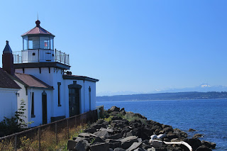
Lighthouse on Puget sound.

A jellyfish that washed ashore. I later ate it (maybe thats why I perished). OK, OK, I didn't eat it and didn't perish.

Friday, August 26, 2011

I have found my weakness...cereal.


Day 8:

   You know how I said that cereal was my favorite food? Well, this morning, I was able to have it again! WAHOO. I know, I am too excited about that, but I really love cereal. In fact, I think I could be bribed with cereal! He he he.Today was a bit of a shorter day, but that is OK by me. We spent said most of the day at the Future of Flight, where we toured the Boeing factory. That was awesome. What made it even more cool, was today the FAA certified Boeing’s new plane. The 787 Dreamliner, which is 20% more efficient at the same speed. After we finished the tour we went out side and were able to watch the aircraft take-off and then do a fly-by! Can you say SWEET!!!! Having seen all that we needed to there, we headed into Seattle right next to the Puget Sound. We walked through Discovery Park to the beach where there was a cool light house! After skipping some stones and collecting some sand, we called it a day. I now have the rest of the evening to relax! Yippee!

End day 8.

P.S. Pictures to come later. 

"Woke up, got out of bed, dragged a comb across my head..."

Day 7:

“Woke up,  got out of bed, dragged a comb across my head…” What!?!? I can't help it, every time I say or hear, "Woke up." I think of the song! Anyway, got to sleep in a bit today which was nice, and had cereal and muffins. YUM! When in the middle of no-where you don’t have many creature comforts, like my favorite food—cereal!  We hit the road again for Seattle! On the way there we were able to see Mt. Rainer from a long way off; that was really cool.

Mt. Rainer (taken from Seattle).

After checking-in to our hotel we headed into the city to explore the wonderful coastal city! We parked right next to where the Mariners and Seahawks stadiums are. Also, in that area was Union Station, so had to stop in so that we have been there. We walked along the wharf for a while, stopped at pike market and walked along the shops until we found the original Starbucks.

The original Starbucks.

 Obviously, we had to stop and get something there, and like always it tasted GOOD! With caffeine coursing through my veins, I had renewed energy for the walk to the Space Needle.

The space needle. (I am the master of pointing out the obvious! :D)

 We didn’t go up to the top, but we did go into the base of it and look around. It’s a interesting building. From there we wandered back down to the water and had some fish and chips at one of the local places. That tasted good.  While waiting for the rush hour traffic to clear up some, we sat and enjoyed the harbor and then we headed back to the hotel where I updated my blog some more.

End day 7.

Goodbye Yellowstone. Hello two more states!


Day 6:

    Having slept soundly through the night, we packed up our tent and all of our stuff into the car and headed north from Norris Junction to Mammoth Hot Springs.  There we were hoping to see some bull elk since we had only seen one and it was hard to see through the thick trees, and also some moose and big horn sheep, which we hadn’t seen at all yet. Unfortunately, we did see any of them. We walked along the salt flats and viewed some more thermal areas in that area.

Mammoth Hot Springs.

Salt flats at Mammoth.

 We then continued toward the north entrance of the park. Along the way we stopped at the 45th parallel which is half way between the equator and the north poll.
 Me at the 45th parallel.

 Along the way out of the park we crossed into Montana. A few minutes later we exited the park. From there we headed for I-90 and left Yellowstone National Park behind us. Once we reached I-90 we headed west. A short while later we stopped again at Three Forks where three rivers come together to make the head waters of the Missouri river.

Three forks.

 That was fun to see although, I have to admit, I had been dozing out on the drive so I was half asleep as I saw it. Oh well! From there we drove a couple hundred miles more through Montana before we reached northern Idaho, the 42nd state that I have been too. We stopped briefly to get fuel in the quaint town of Wallace.  Getting back on the interstate, we continued on until we reached Spokane, WA. Make that 43 states now! There we got a hotel and stopped for the night. It felt good to be able to take a shower again and to catch up on news stories (and my blog). Took a quick swim in the outdoor pool and had dinner, and then rested the remainder of the evening. The comfortable bed called my name and I fell into a restful sleep.

End day 6.

Beaten...by a mountain.

Day 5.

  Having slept much better, we readied ourselves for another day in the park.  Setting out earlier than the day before, we decided that we wanted to go back to Hayden Valley in hopes that the we could see bears a little bit closer than we had. Once there, we heard that there were some wolves off in the distance to the left. Several minutes of searching later, I was finally able to just spot them with my camcorder. We moved to another location along the road hoping to get a better view, but we couldn’t see anything. We went back to the spot we were just at watched some more. We heard that someone might have spotted a grizzly along the tree line, but it went back into the forest and so we didn’t see it at all. As it became later in the morning, we climbed back into the car and went back to Canyon Junction and ate our morning ration of oatmeal.  From there we headed to the northeast part of the park. Hoping to spot some more wildlife in Lamar Valley, we passed by most of the things along the way except for Tower Falls where we briefly stopped to snap some pictures of the waterfall there.

Tower falls.

 Continuing on, we made it to our destination. Sadly, in Lamar Valley, the only wildlife we spotted was a bunch of buffalo and some pronghorn antelope. We were hoping to spot some more bear or some of the resident wolves that were known to prowl that area. We kept driving until we reached Trout Lake Trail. We stopped there and made the half-mile hike to a picturesque lake that was surrounded by meadows. The still water formed a perfect mirror image of the surrounding mountains. We enjoyed the view as we walked around the edge of the lake. 

 Trout Lake.
 Trout lake...again.
Trout lake and I.

With more to see, we headed back down the trail and drove back through Lamar Valley and headed towards Mammoth Springs. Half way down that road we took a one-way dirt road that went through some meadows. The drive had some nice views of the surroundings. From there, we went back towards Lamar Valley, but stopped off at Roosevelt Junction where at Roosevelt Lodge we had massive elk burgers for lunch, which were pretty good. With full stomachs, we drove to the trail that leads to Mt. Washburn. Grabbing our backpacks, we started the climb that winded up to the top of the mountain.

 Trees along the path up.

 It was a 2.6-mile hike up to the top and we had to stop multiple times so that I could take a break. An hour and fifteen minutes later we reached the top. The hike was well worth it. The top gave a panoramic view of Yellowstone.

Top of Mt. Washburn. Elev. 10,243 Ft.

 We rested up there and took in all of the things we could see. At the top of Mt. Washburn is a fire watchtower. Reading a plaque there, there are three manned watchtowers left in the park. The people that man them start in early spring and work until the first major snowfall. They get no days off and are restocked with supplies ever two weeks. I have decided that that would be a fun job to have!

The topmost part is where the watchers live.

 After enjoying Mt. Washburn, we started back down. Fifty minutes later we reached the parking lot. By now it was late afternoon. We were still trying to see some more wolves and bears, so we decided to go back to Lamar Valley and wait there for evening, when they were more active. The first spot we came to we watched for about twenty minutes, but there were no signs of anything so we kept going to another spot that had a lot of people. A small object had been seen moving about, but it hadn’t been identified. We waited for some time searching for it. Finally, Nathan spotted it along the opposite river bank a few hundred yards away. Zooming in, I could clearly make out that it was a lone wolf.

 The wolf about to cross the river.

 We tracked it as it trotted parallel to our spot and then came little bit closer to us. It eventually crossed the river and headed for the road. It crossed the road and then came back across and was eating something. By then, we had moved from our spot to a spot that was slightly closer. We watched for quite a while as it sat, half hidden, eating. After some time it crossed the road again and headed up and disappeared from view. By then, we had gotten lots of pictures and video. We had also heard that there had been some moose spotted further up the road. Following the people who told us about them, we headed for the northeast entrance. Along the way we came across a giant buffalo jam. A large herd was crossing back and forth across the road blocking traffic. Nobody was getting through. Well, almost no one. The person that was leading us to the moose shot passed all of the waiting cars right up to the buffalo. With in a few seconds, we saw him coming out the other side and cruise off out of sight. Hoping that it would clear up soon, we waited for some time, but no progress was made. The decision was made that we should just turn around and head back. Completing the four-point turn on the narrow highway, we were on our way back. At the first pullout we came to, there were a bunch of cars. Slowing down, we asked some people what they saw. They told us it was a grizzly. That is all we needed to hear. Parking on the side of the road, we looked for it. It was laying low, and so it took us several minutes to spot, but eventually we did. This bear was closer, but harder to see with the tall grass and bushes that it was in.

Grizzly hanging out in the tall grass.

 After a while it moved farther out. By now it was starting to get later in the evening so we started the drive back to our campsite. Along the way we had to stop for about twenty minutes for another buffalo jam. After it cleared we made it safely back to our campsite, but by then it was already close to ten o’clock so we skipped making a fire and eating our can of chicken noodle soup. Instead, we settled for a granola bar each. We readied for bed and were soon blissfully asleep.

End day 5.